Showing posts with label maps. Show all posts

Friday, May 29, 2026

A dense forest of pines

This is 'Barbara Codonia', a depiction of the 'landscape' of northern Germany drawn by Dürer or his school, incorporating the names of places and longitude and latitude around the borders. In the northern sea there are islands - Thule (Tyle), probably one of the Shetland Islands, Iceland (Islandi), Scandia, Gottia and somewhere that might be Svalbard. It is an illustration from the Quatuor libri amorum secundum quatuor latera germanie by German humanist Conrad Celtes (Latin: Conradus Celtis), published in Nuremberg in 1502.  These erotic poems were written in praise of Germany and each book had its own heroine. Barbara resides in Lübeck, while in the East there was Hasilina of Cracow, to the South, Elsula of Regensburg and in the West, Ursula of Mainz. The only one of these women that historians have identified with a real person is Hasilina, about whom Simon Schama writes amusingly in Landscape and Memory.

Celtis was altogether an extraordinary figure. ... He studied in Heidelberg, Leipzig, and Rostock before reaching Kraków in 1489, where he had a sensually ecstatic affair with Hasilina Ryztonic, the wife of a Polish nobleman. "How happy I was in that hour amid kisses and embraces holding Hasa's soft breasts in my hands and burying myself in her sweet thighs." Celtis strayed far enough into the Polish countryside to hunt bison, but his view of Poland as a place hopelessly sunk in drunken squalor may have been colored by his rejection at the hands of the passionate but unpredictable Hasa. In his later Liber Amorum she was decisively annexed as one of the four corners of Germany. 

In a 1992 article called 'Desiring the Barbarian' in The German Quarterly David Price describes Celtis's attitude to his four geographically separated lovers. He praises some poems in German from Ursula, albeit tentatively, and then complains that nobody teaches girls Latin. This leads him to imagine instructing her - 'my tongue will pour words into your lips'. He says he will indicate long and short syllables through the length of his kisses. Barbara gets short shrift, criticised for slurred speak when she gets drunk, and Elsula, ignorant of Latin, is castigated for being unreceptive to his songs. 'Haselina, the subject of much of Celtis's best erotic poetry, comes off even worse. Like all "non-classical" women, according to Celtis, Hasilina scorns books. ... Celtis's women resemble the faithless or unreceptive women of Roman love lyric, but they are repugnant to an even greater degree because of their illiteracy in Latin.'

Christopher S. Wood's rich study Albrecht Altdorfer and the Origins of Landscape (a source for Simon Schama's book), views Celtis as a pivotal figure in the identification of Germany with the idea of the forest. 

The key intellectual manoeuvre was the conversion of the forest from the blight into the pride of the land. The forest became at once a hazardous wilderness and a stage for chivalric heroism; it sheltered the satyr, the wild man, even - in Celtis's profound imagination - the Druid priest. The forest became an open-air temple; it became the seat of the Muses. These ideas were so fresh that they could only be put forward tentatively, experimentally, often with tangible excitement. The glamour of the forest lay in its precarious double nature: awe could easily collapse back into fear, mystery into obfuscation, heroism into barbarism.

Wood illustrates the forest's dangers with a pen drawing by Altdorfer showing robbers in action, and notes a similar scene in the Amores of Celtis, who described an encounter on the road between Nuremberg and Regensburg. This is how Celtis sets the scene:

It is a place where hills are lifted from the bending valley,
And a dense forest of pines covers all sides;
In the middle of the space is a well-trodden road in a narrow track;
Watered by a lake, it leads through putrid fields.

Here the thieves spring forth but, 'moved by the poet's supplications (delivered in Latin, if we are to trust the poem),' they spare his life.

Sunday, August 08, 2021

The Succession of Strata


I was recently given the splendid Thames & Hudson volume STRATA: William Smith's Geological Maps, which has contributions from a range of experts and a short foreword by Robert Macfarlane. The book is a thing of beauty as you can see from the gallery on the T&H website. In addition to Smith's maps, it includes photographs of the fossil collection he amassed, which was fundamental to his understanding of geology and which he arranged on sloping shelves to represent different geological strata. When Smith got into financial trouble he was forced to sell these fossils to the British Museum but twenty years later they remained unopened in their boxes (reminding me of a similar story of indifference from a century later, when Apsley Cherry-Garrard donated to the museum an emperor penguin egg collected in the Antarctic after 'the worst journey in the world'). There is an interesting story of social class running through the book, with Smith having to earn his living from practical work in mining and land improvement and only fully appreciated by the intellectual elite at the end of his life.

From a landscape perspective the most interesting drawings are the panoramic sections that show how strata lie underground and where they emerge on the surface. The example above is on a separate bookmark / legend which comes with the book; its reverse shows the sequence of strata and their colours, ranging from London Clay to Granite, Sicnite and Gneiss. The example below (published in July 1819) shows part of Britain I am familiar with, the chalk downs near Brighton. The text underneath the image here is very practical - 'Much Chalk goes from these Hills by the Ouse Navigation to the interior of Sussex and is there used on the Land either in a crude state or burned to Lime by Wood fires for that purpose. The Sussex Clunch or Gray Chalk like that of the Surry Hills makes an excellent Lime for building in Water.' Colourists were employed for his maps but Smith himself was an enthusiastic draughtsman and STRATA includes a selection of portrait drawings of acquaintances from his sketchbooks. To quote Robert Macfarlane, Smith's great map ' now exists somewhere between artwork, dreamwork and data-set.'



Saturday, November 02, 2019

Chateau d'If


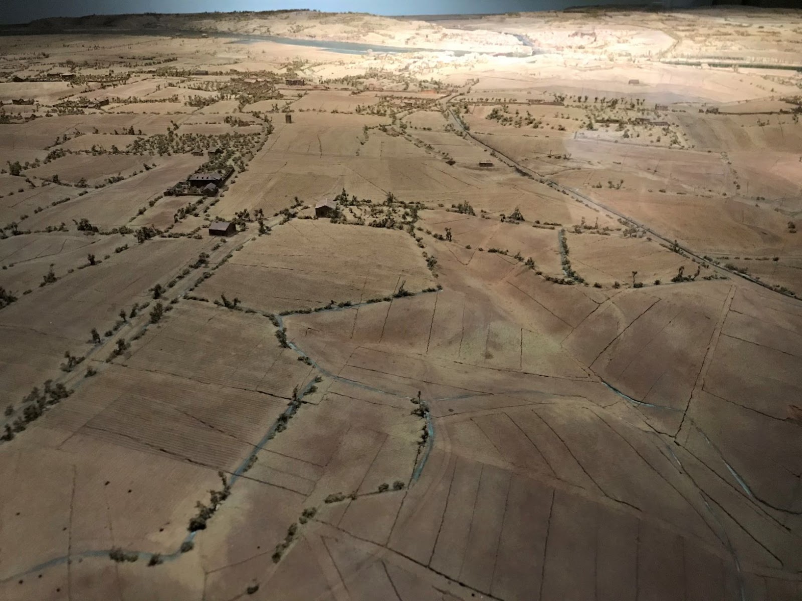
Two years ago I wrote here about the plans-reliefs that Andrew Graham-Dixon visited for a TV documentary - he described them as 'a collection of extraordinary but largely forgotten' table-top landscapes. I mentioned that some of them remain in Paris and last weekend I got to see them - they are on display in Les Invalides.  I framed the photograph above so that this example resembles a real aerial landscape.  However, it is eerily empty - there are roads and buildings but no sign of actual human life: no figures in the fields, no cattle or horses or any other animals.  None of the relief maps show anything happening in these landscapes.  They are quite different from the models we are used to seeing in museums that recreate a key historical event or evoke everyday life at some date in the past.  The plans-reliefs represent a rather bleak vision of the world, as mere terrain to be defended or fought over.  Seeing a relief map of Saint-Tropez in this context was a particular shock - a place that conjures ideas of life at its most joyous - sun, sea, wine, music and Brigitte Bardot on the beach...


Near the glass cabinet dedicated to St Tropez, there is another one containing the Chateau d'If.  I remember that when I first began reading The Count of Monte Cristo I didn't realise that this place, a strangely-named island fortress near Marseilles, was a real location (or that Monte Cristo is an actual island).  But as this relief map from 1681 shows, the Chateau d'If was a key French fortification long before Dumas wrote his novel and the fictional Edmond Dantès was wrongly imprisoned there. Chateau d'Ifs have subsequently multiplied in the many adaptations of Dumas' novel: plays, films and, most recently, video games.  Sometimes other islands have stood in for it - Saint Mary's Tower on Comino, for example, was used in a 2002 film.  Dumas himself would later create another kind of model of the Chateau d'If.  In 1846 he bestowed the name on a grand writer's studio that he had built in the grounds of his country home.  But Dumas spent a lot less time there than Dantès spent in the Chateau d'If - just two years later, short of money, he had to sell it.

Sunday, September 08, 2019

A map of Elmbourne


I have just read All Among the Barley, the third novel by Melissa Harrison, whose writings and nature observations I've been following over the last few years via her prolific Twitter feed.  Looking online afterwards to see what had been written about the novel, I found a piece in Elementum by the artist who drew maps for her book, Neil Gower.  He says that over the years the most indecipherable author sketches he has had to work with are those of Jilly Cooper, 'A2 Basquiat-esque collages of who’s bonking whom (and where)'.  I was actually given a copy of Jilly Cooper's Riders as a joke birthday present recently and have just dug it out to see if it has a map in it.  I can't see one - perhaps they're in her other books?  Anyway, back to Melissa Harrison, who, by contrast, gave Gower very meticulous notes on her imagined Suffolk village of Elmbourne, along with 'stylistic cues in the form of an 1853 tithe map and a 1941 Tunnicliffe map (from Faber’s first edition of Henry Williamson’s The Story of a Norfolk Farm).'  Williamson, author of Tarka the Otter and supporter of Oswald Mosley, is mentioned in the novel - his opinions are admired by Constance FitzAllen, whose arrival from London leads to conflict in the village and confusion in the mind of Edie, the novel's teenage protagonist. 

From the perspective of this blog, I suppose I would rather the protagonist had been this character Connie, so as to learn more about her thinking on landscape.  It would have been interesting to read a bit more about the wider currents of nativist politics and rural revivalism - Lord Lymington, Rolf Gardiner and so on.  But that would have been a different novel; this one is very much contained within the fields and lanes that make up the world of Edie Mather.  According to Gower, Melissa Harrison too 'inhabits the landscape intimately, like her characters'.  For example, she advised him that in 'Suffolk lanes you often get a little triangle of grass left as an island with a white signpost on it. This is because the junctions were formed by carts/wagons and not cars. Carts can't turn such a tight corner as cars can...'  There's a potential paradox here, in reducing such a richly textured place to a two dimensional diagram.  But a map is a portal that can help the reader enter a novel's world and experience more than the author has been able to set down.

A few years ago The New Yorker carried an article on 'The Allure of the Map', beginning inevitably with Treasure Island and Lord of the Rings.  It went on to say that
Genre fiction often involves cartographic illustration, but so, too, do highly regionalist works. Sherwood Anderson commissioned a map of the titular town “Winesburg, Ohio,” as did the novelist Jan Karon for her novels set in the fictional town of Mitford, North Carolina. Henry David Thoreau surveyed Walden Pond for a map that he included in “Walden,” and William Faulkner drew his own map of Yoknapatawpha County for the publication of “Absalom, Absalom!” Faulkner revised the map ten years later for “The Portable Faulkner,” going so far as to call himself “sole owner and proprietor,” and adding a note: “Surveyed & mapped for this volume by William Faulkner.”
The list could be added to with British novels of place: I have mentioned here before Thomas Hardy's sketch map of Egdon Heath in The Return of the Native, for example.  All Among the Barley is part of this history of deeply imagined literary landscapes.

Finally, as a kind of postrscript, I can't resist mentioning another map in that New Yorker article, the one Ursula K. Le Guin drew for the Earthsea trilogy.  Just as I was reading All Among the Barley, my younger son was finishing A Wizard of Earthsea.  We have been talking about the book and he says he loves the way the archipelago contains so many different lands and ways of living.  It made me think about the way books open up our horizons, something that starts to happen to Edie in All Among the Barley...  The map of Earthsea particularly appealed to my son and he has identified on it his three favourite places (Too, Tor and O).  It is clear that he is now sailing his way among those islands in his imagination. 

Sunday, June 16, 2019

Geeooggrraapphhy


Colin Sackett has kindly sent me a copy of Printed Landscapes, an anthology drawing on his earlier books, some of which (like River Axe Crossings and The True Line) have featured on this blog previously. Its cover, as you can see, is plain Manila - no picturesque views here.  In a set of notes, positioned near the middle of the book rather than at the end, he says of this body of work, published since the early 1990s, that
the subjects are commonly about geography, its interpretation and abstraction on the printed page. The locations are often places of familiarity and association, from across southern England, while the book has to do with making connections between its modalities. As with places, or types of places – its subject as such – the reading is intendedly multi-directional.
A few examples can be seen on Colin's website - I've reproduced below an image from 'Geeooggrraapphhy', which comprises overprintings of four maps from London's Country, By Road, Steam and Fieldpath, a guidebook from 1923.  Another work inspired by an old book, The Coast of England and Wales in Pictures (1960), quotes text from the 167 picture captions that describe the coast.  I was pleased to see plenty of cliffs in this - it reminded me of a collage of words to describe the Ligurian coast that I made once here, using words from the poems of Eugenio Montale’s poems in Ossi di Seppia.  W. G. Hoskins, L. Dudley Stamp and Geoffrey Hutchings are all re-purposed in Printed landscape to draw attention to the ways in which places are framed and studied.  In 'Directory' some entries for 'Farmers' from the 1998 Yellow Pages are given, followed by aerial views of farms with their phone numbers.  It made we wonder whether telephone directories are still a thing or have they finally disappeared?  And also of that famous J. G. Ballard quote, that the Los Angeles Yellow Pages was "richer in human incident than all the novels of Balzac". 

Abinger, Albury, Gomshall, Merrow Downs, Shere, Wotton.

One of the entries I particularly like is 'Collection', which reproduces card labels that used to come with bunches of watercress (a shame they couldn't be reproduced in colour).  'Each label,' Colin writes, 'tethered the cress to a typical and identifiable landscape: a clay and chalk valley with water from a spring, or raised from boreholes, channeled to flow gently across wide beds of seeded concrete and gravel.  Seen from above, these planned rectilinear forms impose upon and contrast with the undulating topography on the ground.'  Living in London I don't often think about where watercress grows before it makes it into a salad.  I most associate it with the old Irish story of The Madness of Sweeney (Buile Shuibhne), an outcast who lives on a diet of little else.  Of course watercress labels no longer exist, as we buy the product from supermarkets sealed in plastic.  This collection of 'printed landscapes' has therefore become an archive of signs that remain 'fixed to the activity and geography of their time'.

Saturday, February 02, 2019

The Great Polish Map of Scotland

The Great Polish Map of Scotland
Source: Wikimedia Commons (John Riddell)

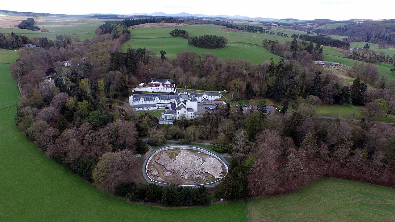
I have written here before about relief maps, focusing on the impressive set of table-top landscapes made at the behest of Louis XIV.  These were relatively portable, indoor objects, but there is also a history of larger relief maps made outdoors.  Such scaled-down landscapes are subject to the same forces of weathering and erosion as the 'real' landscape in which they are set.  Thus, one of the best-known examples, the Great Polish Map of Scotland, has had to undergo a process of restoration recently.  Its concrete is more vulnerable to frost and rain than the gneiss and granite of the Scottish mountains, but, unlike the Highlands, it can always be repaired and maintained in a relatively pristine state.  The map was constructed in the late 1970s at a hotel owned by the Polish war veteran, Jan Tomasik and designed by cartographer Kazimierz Trafas. Water for the sea, rivers and lochs was diverted from a nearby stream.  There are various photographs online - the one below showing the map in snow is quite striking.

 Aerial view in snow
Source: Wikimedia Commons (Novemberscot)

The Great Polish Map of Scotland is 50x40m and has been described as the largest relief map in the world.  However, according to Wikipedia, a site in Ningxia province, China was spotted in 2006 using satellite imagery measuring 900 by 700 metres.  It 'appeared to be a large scale relief model (1:500) of Aksai Chin, a disputed territory between China and India.'  You can find this using Google - I have reproduced the satellite image below.  It is a reminder that the history of relief maps in China, as elsewhere, has always been associated with politics and territorial claims (a map is the territory...)  There are other examples of large-scale relief maps around the world: the Philippines can be seen in reproduced in Rizal Park, Manila, and Guatemala has been scaled down in the 'Mapa en Relieve', as described in an Atlas Obscura article.  Such endeavours have been conceived and executed by scientists rather than artists, but I could imagine some more creative alternatives, relief maps that only partially reproduce a landscape, in order to idealise, reinvent or deconstruct it. 

 A large outdoor relief map in China?

Friday, August 03, 2018

Farther hills as hills again like these

Pieter Breugel the Elder, The Hunters in the Snow (Winter), 1565
Source Wikimedia Commons

To follow up my previous post, drawing on Joseph Leo Koerner's Bosch & Bruegel: From Enemy Painting to Everyday Life (2016), and also to provide some mental respite from this oppressive heat, I thought I would write here today about Breugel's The Hunters in the Snow.  It is a painting I have mentioned here before, in the context of poetry about landscape art ('Jagg'd mountain peaks and skies ice-green / Wall in the wild, cold scene below...' - Walter De La Mare).  It is also a painting loved by Tarkovsky fans as it features in both Mirror and Solaris.  Koerner discusses it in his final chapter, 'Nature', along with Bruegel's other paintings of The Seasons of the Year.  In a rare personal aside, Koerner says that he had a poster of The Hunters in the Snow on his wall right through his college and graduate school years.  Then, despite having a flat in Heidelberg with an 'expansive view of the Neckar Valley' through his window, he was happier losing himself in the depths of Bruegel's painting. 

Koerner imagines the viewer of this painting beginning by focusing on the pack of dogs, before being drawn towards 'one of the deepest depths in European art.'  And yet, 'the paw prints in the snow and the gigantic cliffs are part of the same continuum. Bruegel structures his painting to make our launch into space unavoidable.'  The distances made visible here recall contemporary Flemish atlases. Landscape features like trees and houses are shown in elevation but roads, rivers and valleys are depicted as if in elevation, offering us routes to be followed.  Bruegel reconciles near and far.  As he paints mountains and seas suggesting 'territories yet to be discovered, he pictures them as lifeworlds like our own, those farther hills as hills again like these.'


In the far distance (see above), a procession of figures can be discerned walking towards the horizon over the ice from a harbour town.  The winter before Breugel painted this view, the Scheldt at Antwerp had frozen over.  This flattening of the landscape into a single medium, ice, has effectively 'turned the world into a Borgesian one-to-one map of itself.'  The whiteness of the snow links different parts of the composition, from the hunters marching into the painting to the distant figures heading out of view.  It also dazzles the eye with an overabundance of light.  The roofscape of the mill, covered in snow, is hard to work out at first.  Here, 'Bruegel reverses the elucidating effects that snow has at a distance.'  Thick icicles hang from the buildings. It is a cold village to which the hunters return.  Everyone seems to turn away from us in this picture, 'as nature itself does in winter.  ... Through the mere resources of white paint, Bruegel shows home and the human from the indifferent perspective of the world.'

Sunday, September 03, 2017

A meadow, a wood, and a few peaceful houses

'For anyone who has watched with anticipation as the writings of Robert Walser (1878-1956) have slowly appeared in English over the past two decades or so, Carl Seelig’s Wanderungen mit Robert Walser has been high atop the list of Walser-related books we have wanted to see translated. This is Seelig’s narration of dozens of walks and conversations that he had with the writer over the twenty-year span from 1936 to 1956, when, usually several times a year, he would call upon Walser at a sanatorium in Herisau, Switzerland, where Walser had lived since 1933.  [...] Now, sixty years after its first appearance, Seelig’s book has finally appeared in English as Walks with Walser (New Directions) and it doesn’t disappoint. On those long walks through the countryside and nearby villages, Seelig tried to draw the reticent Walser into talking about his past, his books, other writers, and numerous topics of interest. Walser, it turns out, seems to have been more or less like some of the great characters in his fiction — a delightful and sometimes wily crank who could easily have been mistaken for an unsophisticated soul.' - Terry Pitts, on his always-fascinating Sebaldian blog, Vertigo, 6 July 2017
Last month I had the pleasure of reading Walks with Walser in Switzerland, though sadly not in the region where Walser and Seelig did their walking. I won't set down here my own reflections on this marvellous book because you can read other reviews online - I recommend an excellent piece by Dorian Stuber (like him I am intrigued to know the fate of Bob Skinner's earlier, never-published  translation).  What I have done though, in addition to plotting the dates in a chart (see below - the gaps are in 1939 and 1951), is create a map of the forty-four walks described by Seelig.  Click on one and you will see I have included a short quote which, where possible, relates to the landscape they passed through.  The colours refer to the seasons and my use of a little sporty hiker icon is a joke, because Walser did all these often-strenuous sounding hikes wearing a suit and carrying an umbrella, as can be seen in the photograph used on the book's cover.


Here are twelve of the quotes used on the map:
July 26 1936 (the first walk).
'Silence is the narrow path on which we approach each other. Our heads burning in the sun, we ramble through the landscape - the hilly, tranquil landscape of woods and meadows.'

June 27 1937
'Incidental remark: "Nature does not need to make an effort to be meaningful. It simply is."' 
April 15 1938
'Robert stops often to admire the charm of a hill-top, the sturdiness of a tavern, the blue of the paschal day, the peaceful seclusion of a stretch of landscape, or a greenish-brown clearing.'
July 20 1941
On the way to Appenzell they see a baroque building.
"Shall we look in?"
"Such things are prettier from the outside.  One need not investigate every secret."

May 16 1943
'He says "I don't care a fig about superb views and backdrops.  When what is distant disappears, what is near tenderly draws nearer.  What more do we need to be satisfied than a meadow, a wood, and a few peaceful houses.'
July 24 1944
'As we reach the church in Arbon, an air-raid siren wails.  We hear the crack of antiaircraft guns on the far shore of Lake Constance.  Robert grows quiet.'
April 9 1945
'Far above us, a dogfight. The farmers stop their work and stare at the sky.  Robert, on the other hand, turns to the fir trees and flowers, the clean little Appenzell houses and steep rocky slopes.  For him the whole morning walk is one great delight.'

September 23 1945
'He comments that he often welcomes rain.  It makes the colours and scents more intense, and under an umbrella one can feel quite at home.'

November 3 1947
'A silent hike to Oberberg Schloss, which lies perched on a hill.  The honey-yellow flames of the fruit trees seem to soothe Robert a little.'

January 23 1949
'We climb higher up the Freudenberg, past frozen ponds and into snowy woods.  "It's like a fairy tale," he whispers, laying his hand lightly on my arm.'

Christmas 1952
'We enjoy these springlike hours, praising the woods, Lake Constance, which shimmers like a landscape of dunes, and the joy of walking.'

July 17 1955
The penultimate walk recorded by Seelig. 'Is his condition more serious than I realize?  I am wracked with worry.  As we part his last words are: "Did you see the heavenly colours of Lake Constance?"'
I have chosen these quotes because they convey an idea of Robert Walser's attitude to landscape, something I have discussed here several times before, e.g. in his novel The Assistant.  But they give a very unrepresentative idea of Walks with Walser, which is full of fascinating biographical material and Walser's thoughts on writers and books.  Then there's the food... I could easily have made an alternative Google Map based on the breakfasts and lunches the two writers enjoyed on their day-long excursions.  Last month I visited the Robert Walser Zentrum in Bern and talked to one of the team there about Walks with Walser - we agreed that both the length of the walks and the writers' appetite for good food and wine afterwards was impressive and life-affirming.  There is great poignancy in the contrast between these moments and Walser's daily life in the hospital at Herisau.


I took these two photographs in the Robert Walser Zentrum.  The first shows a beautiful, very expensive set of Walser manuscripts published by Schwabe, the world's oldest publisher (founded in 1488).  The second is a bookshelf which gives the impression there is still a lot more by and about Walser that it would be wonderful to have in English.  In one of the last walks with Walser, Seelig told him about the first English translations that had just appeared, done by Christopher Middleton 'with admirable sensitivity'.  Walser responded 'with a curt "Really!"'  Walks with Walser ends a few pages later with Walser's death during his final solitary walk on Christmas Day 1956.  There is snow everywhere and the sun is weak, 'tenderly melancholic and hesitant, as if today it would like to give the lovely landscape over to night sooner than usual.'

Friday, February 24, 2017

Plans-Reliefs


If you have access to the BBC iPlayer you can see Andrew Graham-Dixon's latest series, an attempt to tell the story of the Art of France in three hours.  The first episode stretches over the centuries from L'abbé Suger to Chardin.  During the course of this, he visits Versailles and looks down on its gardens, with their panoptic design of paths radiating out from the palace of the Sun King.  But he also finds time for a visit to the basement of the Palais des Beaux-Arts in Lille where he wanders among 'a collection of extraordinary but largely forgotten' table-top landscapes, made at the behest of Louis XIV.
"They were all made for the king, these great tables.  Each one is a town - a representation of a town that he had fortified.  This is Ypres.  This is Tournai.  There were originally a hundred and forty-four of these objects.  They occupied 8,000 square meters of the Louvre - nearly a mile to walk past all of them.  And what they represented I think for Louis was a tangible demonstration of the extent to which he had expanded and secured France's borders.  They also served a very practical purpose because when he came here with his generals or his advisers he could plan strategy.  He could literally feel with his hand the lie of the land.  And he could enjoy, as no-one else in the world could do, a bird's-eye view of these strategically important cities.  I think the Plans-Reliefs as they are called (it's extraordinary - goodness knows how many man hours went into their creation) - I think what they represent is a making good of the promise that Versailles holds out.  That, yes, the king's eye stretches to the very end of the realm."
This collection of relief maps has a complicated history.  Having been only accessible to Louis XIV and his staff, they eventually came to be seen as works of art, on show once a month to the public during the nineteenth century.  A new set of relief plans were made for Napoleon, seventeen of which were taken by the Prussians to Berlin after his defeat.  These were almost all destroyed during World War Two, but one of them, the map of Lille, was restored and returned to France.  Of the original seventeenth century plans, some are still in Paris and some have been transferred to Lille, where Andrew Graham-Dixon saw them. 

Earlier, smaller relief plans were made in sixteenth century Venice and Bavaria.  The Bavarian plans were the work of Jakob Sandtner (fl. 1561-79) who seems to have made the first one himself, which then came to the attention of Duke Albrecht, who bought it and commissioned others.  But these were city plans - what I like about the French Plans-Reliefs is that they show the surrounding terrain.  The inclusion of woods and fields was consistent with their use as a military tool.  But their usefulness declined as technology 'improved'.  Eventually, as the director of the Paris musée des Plans Reliefs explains in an interview, the range of cannon fire was too great for maps on this scale.  It is tempting though to imagine modellers trying to keep up, at work on ever larger constructions, eventually covering the whole of France and fitting together like a jigsaw.

Friday, December 02, 2016

Straight Outta Compton

Here's an extract from Evelyn McDonnell's interview in the LA Review of Books with Paul Beatty, about the novel that has just won the Booker Prize
'The Sellout is set in an inner-city rural neighborhood called Dickens. Yes, that’s right, an inner-city rural hood. There are rodeos, ranches, and orchards amongst the donut shops, and shootouts. The narrator is a farmer who nurtures exotic fruits, along with killer weed. Call The Sellout a ghetto pastoral.
Or don’t.
“I try not to use that word at all,” Beatty says when asked if he cast The Sellout in the great literary tradition of the pastoral. “That was one of the hardest things about the book, trying to make that neighborhood feel real and a little bit fantastical at the same time; that was so hard to do.”
Beatty mixes the factual and the fanciful. The town name is made up (sly nods to the actual founder of Compton, Griffith Dickenson Compton, and to the father of social realist novels, Charles Dickens), and the setting may sound surreal, but in fact, Dickens is based on an actual Los Angeles area: Richland Farms, straight inside Compton. Yes, in the area made famous by Niggaz With Attitude and Kendrick Lamar — the town known worldwide as the home of gangs and gangsta rap — there are horses, goats, corn, and chickens. There really is a rodeo in Compton. Paul didn’t make that up.'
It is hard to read The Sellout without getting interested in where truth ends and fiction begins.  I found myself trying to get a clearer picture of Richland Farms via Google Earth - it's hard to detect any actual agriculture going on although maybe I just haven't looked down the right streets.  You don't need much space for the kind of city farms we have near where I'm writing this in London, at the equally bucolic sounding Holloway and Bethnal Green.  But it has to be said that even in the fictional version of Compton, it is only the novel's central character who maintains an actual working farm.  Whilst his neighbours have largely given up, he still rides a horse and has vegetable plots, fields that rotate from wheat to rice paddy, vines, cotton (symbolic, unpicked), unusually-shaped melons and satsumas so succulent 'they damn near peel themselves'.  At one point he recalls teenage years reading aloud from Kafka's Amerika with his girlfriend and there is something of that novel's surreal not-fully-urban version of an American city in the idea of Dickens.

A Google Earth view in the Richland Farms district of Compton

The Sellout may not be a pastoral but it is a book about place and the way districts change: the decline of Dickens from a prosperous independent city to a rundown district of LA is an echo of Compton, a once-desirable location where George and Barbara Bush lived in the late 1940s.  Critics have said that the novel resembles a set of comic routines and one of the best involves the idea of a kind of dating bureau for matching up 'sister cities' (the joke works less well with the British version 'twin towns').  Dickens is offered three possibilities: Juárez, the most violent city in the world, Kinshasa and Chernobyl.  But it is the disappearance of Dickens as a separate entity that hurts the novel's hero most, and his first protest against this is to paint and erect his own road sign.  Pleased with his handiwork, he feels 'like Michelangelo staring at the Sistine Chapel after four years of hard labor, like Banksy after spending six days searching the Internet for ideas to steal and three minutes of sidewalk vandalism to execute them.'  His increasingly outrageous local interventions as the novel progresses end with a trial on charges of reintroducing slavery and segregation.  Back at home, waiting for the verdict, he is watching the local weather on TV when he notices that it includes the word 'Dickens'.  He has literally managed to put his city back on the map.

Friday, April 22, 2016

The Black World


I did a post here back in 2010 about Trevor Paglen, the artist-geographer who has explored the 'black world' of US military and intelligence agencies.  I focused then on his 'limit telephotography' in which restricted landscapes, cut-off and unseeable with the naked eye, can be glimpsed using high-powered telescopes.  Today I popped into an excellent small exhibition of his work to coincide with the Deutsche Börse prize (like the exhibition of Richard Mosse photographs I described here two years ago).  Three exhibits of particular interest from a landscape perspective:
  • They Watch the Moon (2010), which you can see above in the window of the Photographers Gallery, is a beautiful vista of hills completely covered in rich green vegetation.  At their centre, a constellation of artificial lights and the dishes of telescopes arranged in a circle like orbiting moons.  In an essay on Paglen's work, 'Visiting the Planetarium: Images of the Black World', Brian Holmes has written of this photograph that whilst we may see in it something grand, an image of the cosmic relation of earth and sky, in fact 'the radio telescope depicted is devoted to banalities: it picks up stray cell-phone conversations bouncing off the lunar surface from halfway around the globe.'
  • Untitled (Reaper Drone) 2010, is just as visually stunning: a late-Turner swirl of yellow light - the desert sky near Las Vegas - and caught in the image the tiny silhouette of military drone.  This series of photographs, the curators explain, are achieved with a large-format camera trained on the sky: 'when the film is developed, small insect-like drones are peppered throughout the images.'  There is another, Untitled (Predators), not in the exhibition, which could be a high cirrus sky over Suffolk - an ominous contemporary version of Constable's cloud studies.
  • NSA-Tapped Fiber Optic Cable Landing Site, Marseilles, France (2015) partly comprises another large-scale landscape photograph, juxtaposed with a nautical map onto which various diagrams and images have been pinned like the visual prompts on a crime investigation board.  The view of rocky islands in the bay of Marseilles inevitably brings to mind The Count of Monte Cristo, a novel that features surveillance, secret locations, political plots and, here where the NSA-tapped cable came ashore, the fortress prison where the novel's hero is cut off from all communication with the outside world. 

Paul Cézanne, The Bay of Marseilles from L'Estaque, c. 1885
(a postcard of this painting is one of the items Paglen has attached to the map of Marseilles)

Having written this I see that the Photographers Gallery have just today posted an interview with Paglen on their website.  In this clip, embedded here, he talks in front of the map of Marseille about the way his work aims to make visitors look at the world more closely and more suspiciously.

Friday, March 25, 2016

Topological loss

The building work I mentioned a fortnight ago is well underway, covering everything in layers of dirt from crumbling Victorian bricks so that any neglected surfaces begin to look like Man Ray's Dust Breeding (1920).  Meanwhile I have been reading this week about the first study of London's air quality which puts a figure on the number who die prematurely from the long run effects of nitrogen dioxide and dangerous fine particulates.  Such airborne pollutants have been used by the Italian artist Luca Vitone for a new kind of plein air landscape art, canvases that capture the grey substance of the city that we all have to breathe.  He has also made similar works from the kind of dust I am surrounded by now: Rooms (1914) comprised four watercolours made from dust collected in the German Federal Court, Bundesbank, Bundestag and Berlin's Pergamonmuseum.  You can see an example of a dust piece accompanying an article on Vitone in Frieze from a couple of years ago.  In this overview of Vitone's art Barbara Casavecchia discusses other works that deal with a sense of placelessness:
'In 1988, at the age of 24, Luca Vitone began working on ‘Carte Atopiche’ (Atopic Maps), a series of 1:25,000 scaled maps from which he removed all topographic indications. [...] ‘All my works reference a condition to which we are subject, which I call “topological loss”,’ Vitone explained in an interview with the critic Emanuela De Cecco in 1992.2 So deep-rooted were his feelings that he had the geographical coordinates of his place of birth, the Galliera hospital in Genoa (Lat. N. 44°24’07’’ Long. E. 8°56’31’’), tattooed on his arm, while his website constantly updates his position with a tracking system. Travelling widely and regularly exhibiting internationally, Vitone (who is now based in Berlin) compensates for his placelessness through constant scrutiny of his relationship to the contemporary Italian landscape, which he transforms into minimalist installations, soundscapes and, more recently, monochromes and videos.'  
The article concludes with a description of Vitone's recent work in which visitors to the Venice Biennale were confronted with a scent that the artist had developed 'in collaboration with the master perfumer Maria Candida Gentile by mixing three rhubarb essences.'  This was no perfume though, it was designed to evoke the smell of asbestos. For Vitone there was a particular association with asbestos-related deaths in Piedmont.  (When we first moved in here we were told by the man who dismantled an old structure in the garden that he thought it contained a small amount of asbestos. In mentioning this I should point out that our garden is pretty small and a significant portion of it constitutes an inconvenient ivy-clad mound that we understand to be a concreted-in World War Two air raid shelter nobody has had the energy or money to have removed.  Still, I suspect this visible remnant of the past is something of an antidote to feelings of placelessness and topological loss). 


After Venice, Vitone and Gentile created a new olfactory sculpture for an exhibition in Berlin, Imperium (2014), 'composed of different fragrances, which together evoke the “smell of power”' (something I think I may have sniffed before). Olfactory landscape art may well be a growing trend.  One of the best known artists working with smell, Sissel Tolaas (who recently featured in The Guardian) is also based in Berlin and made an installation charting the smells of its districts back in 2004.  The city is also home to a Smell Lab dedicated to olfactory experiments.  The results from one of its field trips are not hugely impressive ('Piece of Textile Left for an Hour Underneath a Rug at a Späti on Kottbusser Damm' - 'Smells like Nothing'), but I guess this kind of smellscape research is still in its infancy.  It is not yet possible to embed smell clips into these blog posts so I have added a short video about Luca Vitone above.  Now, on a fine evening here in Stoke Newington, I think I can smell the spring at last, overlaid with a whiff of brick dust and a hint of ancient soot from the old kitchen fireplace we have just uncovered.

Fragment of old wallpaper, Stoke Newington, date unknown

Monday, February 22, 2016

Utopia

 Ambrosius Holbein, The Island of Utopia, 1516

2016 marks the five hundredth anniversary of Thomas More's Utopia.  The book has little in detail to say about Utopia's topography, although we are told that it was once a peninsula, before a channel was cut through the isthmus connecting it to the mainland, creating a crescent shaped island that is like one great harbour.  The land itself is not especially fertile but the Utopians make good use of their natural resources and enjoy their communal gardens.  In his introduction to the Penguin translation Paul Turner provides an amusing overview of utopian and dystopian literature, from the vision of paradise in The Epic of Gilgamesh  to recent novels by Huxley, Orwell, Evelyn Waugh and Mary McCarthy.  More's chief model was Plato's Republic, in which Socrates describes his ideal state.  It is in Plato's Critias however, that he imagines an actual location for a utopian society: the island of Atlantis, formed of concentric rings with springs that provide both hot and cold water.  Before Plato, Paradise was imagined in the form of Elysium, which Homer located on the western edge of Earth. Turner writes that in The Odyssey 'the description of the Elysian Fields stresses chiefly the superb weather-conditions; but Lucian, completing the picture later, represents Elysium as a luxurious holiday-camp, with honey and scent laid on, permanent background music provided by nightingales, and self-filling wine glasses.'

Ambrosius Holbein, The Island of Utopia, 1518

The first edition of Utopia came with a sketch-map of the island by Hans Holbein's elder brother Ambrosius.  However a slightly different version appeared in 1518, within a book devoted to the work of More and Erasmus that had engravings by both of the Holbeins.  In this new version the ship's position in relation to the island makes it resemble a skull, slightly reminiscent of the famous anamorphic skull in Hans Holbein's The Ambassadors.  There is an interesting article on this in the British Dental Journal which suggests that Erasmus may have suggested a memento mori design as a pun on More's name.  At first I thought special dental techniques had been used in this research and that there might have been something uniquely interesting about the 'ship of teeth'.  However, the article is actually an excursion into art history by a practising dentist whose 'experience in dental radiology' heightened his perception of concealed anatomical structures.  It is a striking idea that the particular viewpoint dentists habitually have of our upturned faces may lead them to read landscapes differently (not what Woody Allen had in mind I think when he wrote 'If the Impressionists Had Been Dentists').  The Utopians may have had need of dentists, as their meals ended with a great variety of sweets and fruits.  Dentists are not mentioned explicitly but Utopia has a plentiful supply of medical equipment, experienced doctors and sympathetic nurses, so that 'practically everyone would rather be ill in hospitals than at home.'

Friday, February 12, 2016

The Coast of Bohemia

Joseph Wright of Derby, Antigonus in the Storm, 1790-2

On Tuesday we went to see The Winter's Tale at the atmospheric, candlelit Sam Wannamaker Theatre.  I am sure I was not alone in looking forward to seeing how the director dealt with Shakespeare's most famous stage direction: 'Exit, pursued by a bear'.  When it came, this scene played out in near darkness, rightly leaving a lot to the imagination.  This worked well not just because it must be hard to convincingly stage an unexpected bear attack, but because the pursuit takes place on the non-existent desert shoreline of Bohemia.  Perhaps we are not meant to try too hard to picture the surrounding landscape.  Nevertheless, I love the way Joseph Wright has endeavoured to imagine this scene as it might actually have occurred, depicting the rocky beach where Antigonus was pursued and met his grisly end, 'torn to pieces with a bear.'  This painting is in Ontario where it has been shown alongside sound machines traditionally used in 18th century theatre productions, one imitating the wind (canvas passing over wood) and the other rain (beads rotating in a drum.)

Much speculation has gone into Shakespeare's setting for this part of the play.  Some historians have thought he cannot have meant Bohemia and was referring to somewhere else - Apulia, perhaps, or Bithynia.  Others have pointed to the play's source (Robert Green's pastoral Pandosto) which also refers to Bohemia's coast, or have explained it in terms of the political advantage in siting the action in the country of an ally of James I.  But pastoral has never been at all realistic and Shakespeare probably felt as free to imagine 'Bohemia' as his contemporaries would Arcadia.  This is not the only point in the play where reality and fantasy fuse: the actual Renaissance artist Giulio Romano is referred to as sculptor of the statue of Hermione that miraculously comes to life (Giulio was a painter, not a sculptor).  Shakespeare's Bohemia reminds me of another mythical place that I wrote about here before, Kafka's Amerika.  Kafka created a version of that distant continent that was a kind of 'exploded Bohemia'; Shakespeare's coast of Bohemia is similarly a country drawn out of dreams and desires (Kafka on the shore, one might say).

Gelett Burgess, A Map of Bohemia, 1896

In A Time of Gifts the young Patrick Leigh Fermor, walking alone along the Danube near the southern edge of old Bohemia, thinking of The Winter's Tale, dreams up his own theory.  'As I marched downstream, inspiration struck.  'Coast' must originally have meant 'side' or 'edge', not necessarily connected with 'sea' at all!  Perhaps this very path was the Coast of Bohemia - at any rate the Coast of the Forest: near enough!'  Remembering the plot, he imagines a route for Antigonus: sailing from Sicilia to Trieste, overland to Vienna and then up the Danube. 'The ship, running into terrible storms, probably among the Grein whirlpools, founders.  Antigonous, the old courtier, scrambles ashore, - perhaps just under the castle of Werfenstein!' The bear would have emerged from the forest and Act IV's sheep-shearing festivities might have been celebrated in one of the nearby farms.  It is a wonderful moment of creative excitement... followed by crushing disappointment when he arrives at Vienna, checks the play text and realises that Shakespeare's didn't actually use the word coast at all:

SCENE III. Bohemia. A desert country near the sea.  

Later, unable to give up on his speculations, Leigh Fermor has a second moment of jubilation after an afternoon spent in his host's library searching for connections between England and Bohemia.  'The windows of the flat looked down on the whole of Prague.  Towards the end of my search, the pale sun had set among those silver and purplish clouds and at lighting-up time all the lamps of the city had leapt simultaneously to life.'  His host suddenly has an idea and takes down a history book.  It explains that Bohemia did briefly have a coastline, when its territory extended to Dalmatia.  Celebratory drinks are poured in a mood both victorious and valedictory, as the young literary detective is set to leave Prague and head off again on his slow journey to Istanbul.  Years later, writing the book, Leigh Fermor looks back on all this with the knowledge that Shakespeare's comedies always have an imaginary topography...
'Woods and parkland on the Warwickshire, Worcestershire and Gloucestershire borders, that is; flocks and fairs and a palace or two, a mixture of Cockayne- and Cloud-Cuckoo- and fairyland with stage mountains rather taller than the Cotswolds and full of torrents and caves, haunted by bears and washed, if need be, by an ocean teeming with foundering ships and mermaids.'

Friday, October 09, 2015

An eagle, a mountain, a ship

George Frederic Watts, Portrait of William Morris, 1870

When, in the summer of 1996, the V&A held an exhibition to mark the centenary of the death of William Morris, it seemed rather out of tune with the times - Cool Britannia, the YBAs and all that.  This was years before Jeremy Deller used the heroic figure of Morris in his Venice Biennale exhibition and then juxtaposed the output of Morris and his company with Andy Warhol and The Factory.   Making my way round that V&A exhibition, I felt rather pleased and vindicated when I spotted Brett Anderson from Suede peering into a display case just in front of me.  Perhaps Jeremy Deller was there too, unknown to me then (as The Guardian explained, he 'was of the same generation as Damien Hirst and the YBAs, went to the same parties, but never made any money'.)  Now it occurs to me that perhaps it was Jeremy Deller I saw, as he does bear a certain resemblance to Brett Anderson.  Writing this I am painfully aware that 'seeing Brett Anderson' has become what I most remember about the exhibition, despite having enjoyed it and come home with the catalogue.  I probably knew at the time that this moment was something that would unavoidably 'strengthen into memory'...
— Getting clearer now as it wears

The worn-down landscape.  Torn and bald and filled.

You know what will strengthen into memory: an eagle, a mountain, a ship.

As a place becomes somewhere you are starting to remember, it empties out and becomes more absolute.

It becomes the map.

Is it after all you who studies the map?
Lavinia Greenlaw, Questions of Travel: William Morris in Iceland
The Map: William Morris's 1871 Journey to Iceland
There is a full size version at the William Morris Archive

In her book Questions of Travel, Lavinia Greenlaw extracts particular phrases in William Morris's Icelandic Journal and uses them to formulate brief observations on the nature of journeys.  The examples above are also questions of landscape: how we regard it, how we remember it afterwards.  They were prompted by the page in which Morris describes a ride across the plain of Helgafell:
.... The mountains we look back on, toothed and jagged in an indescribable but well-remembered manner, are very noble and solemn. As we rode along the winding path here we saw a strange sight: a huge eagle quite within gunshot of us, and not caring at all for man, flew across and across our path, always followed by a raven that seemed teazing and buffeting him: this was the first eagle I had ever seen free and on the wing, and it was a glorious sight, no less; the curves of his flight, as he swept close by us, with every pen of his wings clear against the sky was something not to be forgotten. Out at sea too we saw a brigantine pitching about in what I thought must be a rough sea enough. The day has been much like yesterday throughout, and is getting clearer now as it wears.
Edward Burne Jones, William Morris in Iceland

When I picked up Questions of Travel (one of those appealing little hardbacks published by Notting Hill Editions), I recognised the title as a reference to the Elizabeth Bishop poem, but was expecting an account of a journey in the footsteps of William Morris.  I was probably thinking of Moon Country (1996) in which Simon Armitage and Glyn Maxwell travelled to Iceland in emulation of Auden and MacNiece.  However Lavinia Greenlaw says she was not on the trail of an earlier poet: 'I didn't go to Iceland because of Morris but, like him, because of my idea of the place.'  Morris, nonetheless, was very much inspired to travel by his reading - something that comes over clearly in the Iceland chapter of Fiona MacCarthy's wonderful 1994 Morris biography.  She describes him as 'certainly the first Englishman in Iceland who arrived with such a knowledge of its language and literature'.  Shortly after leaving Rejkjavik he was already noting the locations of Njáls saga and towards the end of the trip he tried out the hot-spring bath beside the house of Snorri Sturluson.  Helgafell is where the Laxdœla saga's extraordinary heroine Guðrún Ósvífursdóttir lived and was buried.  Morris also described this 'terrible place' in a letter home to his wife Janey.  His first impression was of 'a great sea of terribly inky mountains tossing about' but, he continued, 'there has been a most wonderful sunset this evening that turned them golden.'


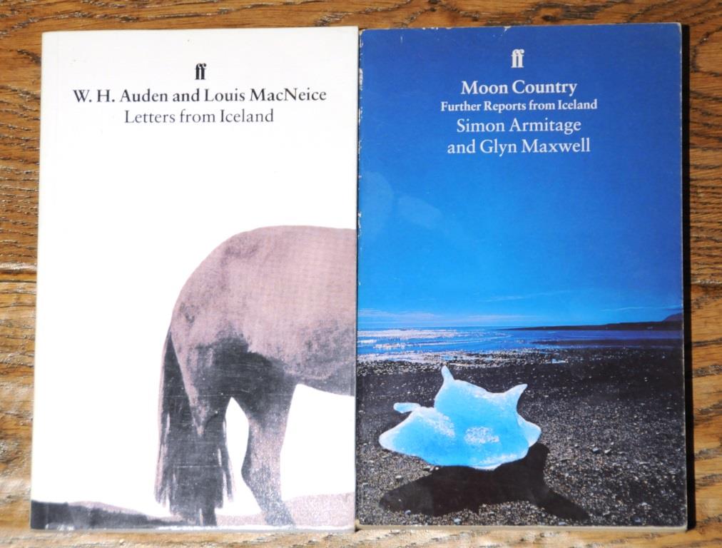
William Morris is quoted in Letters from Iceland and mentioned in Moon Country: at one point Armitage and Maxwell add their names to a visitor's book Morris had signed.  Shortly afterwards they find a piano Auden and MacNiece had played and sit down to attempt 'the one song they both knew, 'Perfect Day' by Lou Reed.'  In 1936, Auden had complained about the sameness of Icelandic music but 'got some gramophone records of more primitive local music, including an amazing one of a farmer and two children who yell as if they were at a football match.'  Simon Armitage brought his own supply of tapes, including Talking Heads, The Fall, The Smiths and, naturally, Björk.  Lavinia Greenlaw is reticent in the introduction to Questions of Travel about her own experiences of Iceland but one might guess, based on her extensive writings about music, that she took a pretty fine selection on the iPod.  Back in 1871, William Morris had to be happy with what music he encountered on the way.  One morning a 'little maiden' played a langspil - the ancient Icelandic fiddle - for him, 'but it was sadly out of tune.'  
   

The Icelandic Journey has itself now been turned into music: a composition for chorus and orchestra, Earthly Paradise, by Ian McQueen.  Fiona MacCarthy wrote about in an article for The Guardian that also mentions Lavinia Greenlaw's then work-in-progress.  Morris's original poem 'The Earthly Paradise' 'was the work that brought him real fame. In this poem he develops one of his great themes: the ruination of the land. Morris had been watching with increasing horror the rampant industrialisation of Britain and the damage caused to the environment by uncontrolled factory production: poisoned air, polluted rivers, tracts of industrial waste. Iceland, by contrast, was purity itself, and his travels through the mountains braced him and inspired him for the years of environmental campaigning ahead.'  MacCarthy concludes her piece by wondering why it is that Morris retains his appeal to new generations of admirers.  'It has something to do with his peculiar, irascible, enchanting personality, still vivid in our age of triviality and blandness. At a time of endless half-truths and moral shilly-shallying, Morris's eccentric integrity shines out.'

Friday, September 25, 2015

A chromatic view of the Earth


In his history of ballooning, Falling Upwards, Richard Holmes mentions 'the first aerial drawings ever made from a balloon basket'.  He is referring to the engravings accompanying Airopaidia (1785) by Thomas Baldwin, an account of a flight from Chester to Warrington.  In addition to a map of the route there are three of these, each of a different kind.  The most traditional (above) shows a view of the balloon itself, heading over the the Crag of Helsbye.  But this landscape is very different from the flattened prospect Baldwin observed from above, where the 'lofty Summit was apparently reduced to a common Level with the Valley made by the River Wever, and with the adjacent Sea Marsh.  Nor could it have been distinguished by a Stranger, as an Eminence.’


The 'Specimen of Balloon Geography' below gives an idea of what Baldwin actually saw from the balloon.  Having taken a map with him, he was surprised to see how different the landscape appeared, revealing for example the ‘incredible Variety of most beautiful Curves, into which the Stream had worked the Bed of the River Wever in a Course of Time’.  Altitude and a new perspective transformed the colours of familiar landmarks: the River Dee was the ‘Colour of red lead’ and Chester, thanks to its roof slates, appeared blue.  Sunlight on pits or ponds of water gave the ground the appearance of an inverted firmament.  Distance lent clarity to the scene below and reduced the landscape to a simplified range of primary colours.  ‘This unmixed Coloration of Objects, from a vertical Situation only, to be seen without Refraction, is a new singular and pleasing Phenomenon.  A View, taken above the Level of the Clouds, may, from this Circumstance, without Impropriety, be called a CHROMATIC VIEW of the Earth: of which, the Print is an Example.’
 

The final engraving is a curious circular image, slightly reminiscent of Dante's Paradiso.  There are instructions to the reader for viewing this, which might still work if you are looking at this blog post on a mobile device.  Lay it flat on a table and view it through a small opening made by rolling a piece of paper into a tube whilst shutting the other eye.  You will then 'form a very accurate Idea of the Manner, in which the Prospect below was represented gradually in Succession, to the Aironaut; whose Sight was bounded by a Circularity of Vapour.' 


The balloonist has 360 degrees to contemplate in a state of perfect calm and soothing silence.  One can look down at the landscape or around and above at the cloudscape.  Thomas Baldwin saw these choices in terms of the Beautiful and the Sublime, well established categories by this point (Edmund Burke's book on the subject had appeared in 1757).  Early in the voyage he writes of being unable to 'withstand the Temptation of indulging his Eye with a View of the glorious and enchanting Prospect.  But the Beautiful among the Objects below was still more attractive than the Sublime among those around.’  Later though he concludes that a balloon ride offers a synthesis: ‘the BEAUTIFUL and SUBLIME were seen united, in a Manner perfectly novel and engaging.'

Sunday, September 06, 2015

View of Pernambuco, Brazil


I have added a new feature to this blog - maps.  Click on one of the links above and you get a zoomable Google Map with pins connected to the 'locations' of my earlier posts (see example above).  Over the years I haven't written specifically about individual places of course, so the geotags tend to relate where relevant to the main subject of the artwork, or of one of the artworks discussed.  Some landscapes have been non-specific, ideal or imaginary so the maps do not include all my old posts.  As I write this, I have not yet finished going back through them all and adding tags - enjoyable but laborious, even if it is improving my geography.  It is throwing up a few interesting problems; I found, for example, that Anahorish, celebrated in poetry by Seamus Heaney, officially 'doesn't exist'.  There are some technical limitations to the maps (no embedded audio or video), and to the way RSS feeds work that mean I have had to split posts over several maps rather than having just one (nor can I host them here, so thanks to my friend John for putting the code on his own site).  Also, these are not really designed for small mobile devices, although they do work on my iPad.


Frans Post, View of Pernambuco, Brazil, ca. 1637-44

For me it has been interesting seeing where I have and haven't written about - very little on South America for example.  Googling Brazil and landscape art I see that that, apart from the renowned landscape architect Roberto Burle Marx, you tend to get references to a seventeenth century Dutchman, Frans Post.  He is an interesting artist.  The familiar view of colonial painters is that they were conditioned by European attitudes and painting conventions, excluding as much as they included, producing views that resemble the Roman Campagna with added palm trees.  Whilst Post was in Brazil, he managed to make it resemble the Netherlands with low horizons and grey skies, but he also included details taken directly from nature.  Once he was back, colour flooded in and his compositions became more idealised, whilst the figures (often slaves) were relegated to mere details.  In 1648 he painted the landscape elements of a Biblical scene, the Sacrifice of Manoah, giving it a Brazilian setting, complete with armadillo and iguana.  According to Seymour Slive, in his survey of Dutch Painting 1600-1800, 'the rather naive quality of Post's pictures has earned him the title of the 'Douanier Rousseau' of the seventeenth century'.

Friday, July 10, 2015

Vision of a possible city


In 2012 William Kentridge delivered the Charles Eliot Norton Lectures at Harvard University.  This was the lecture series that gave us Italo Calvino's wonderful Six Memos for the Next Millenium (he died before he could deliver them); I wonder how differently these might have been conceived now, in the age of Ted Talks and multi-media.  It is no surprise that an artist like Kentridge interspersed his words with film clips or that Harvard University Press have produced an enhanced e-book of the lectures, Six Drawing Lessons.  However, I've been reading an old-fashioned hardback version and thought I'd share here a few observations he makes on the history and geography of Johannesburg, a city he has lived in his entire life.

Johannesburg is a city that has 'an entirely geological justification'.  When a meteor struck the land it's impact caused a thin seam of subterranean gold to be tilted so that it met the surface a hundred kilometers from the impact site.  After the discovery of gold in 1886 Johannesburg was, for its first thirty years, the fastest growing city in the world.  There is a map made in 1889 that shows the physical landscape, the initial constructions (see photograph below) and 'a vision of a possible city.  At the time the map was drawn and printed, only about 3 percent of the streets and buildings and suburbs on it had been made.  It is extraordinary that now, 120 years later, almost all the map exists as a physical fact.'


Kentridge goes on to describe an episode that would have intrigued Calvino, author of Invisible Cities and The Baron in the Trees.
'Around 1900, at the end of the war between the British and the Afrikaners for control of the gold mines, the city of Johannesburg, wanting to keep the demobilized soldiers busy rather than drunk, employed them at a penny a tree to plant a forest of a million trees on the pavements and gardens of the city.  Johannesburg, by its own and some outside estimations, is the largest man-made forest in the world.  From my studio, you look out over an undulating sea of treetops.'
The lush gardens and trees are sustained in this naturally dry, inhospitable land by irrigation that brings water from rivers hundreds of kilometers away. 'The streams of the city itself are miserable ditches, stormwater drains awaiting the rainstorms.  But underground, where the mining is, it is the reverse.'  The continual pumping away of this water has left the ground prone to sinkholes, an unstable foundation for the racially segregated suburbs.  'In my childhood there were stories of an entire tennis match - the umpire on his high chair, the tea and orange juice on the table next to the court, the family Labrador - all being swallowed by a huge sinkhole, never found, never recovered.'