The Great Polish Map of Scotland
Source: Wikimedia Commons (John Riddell)
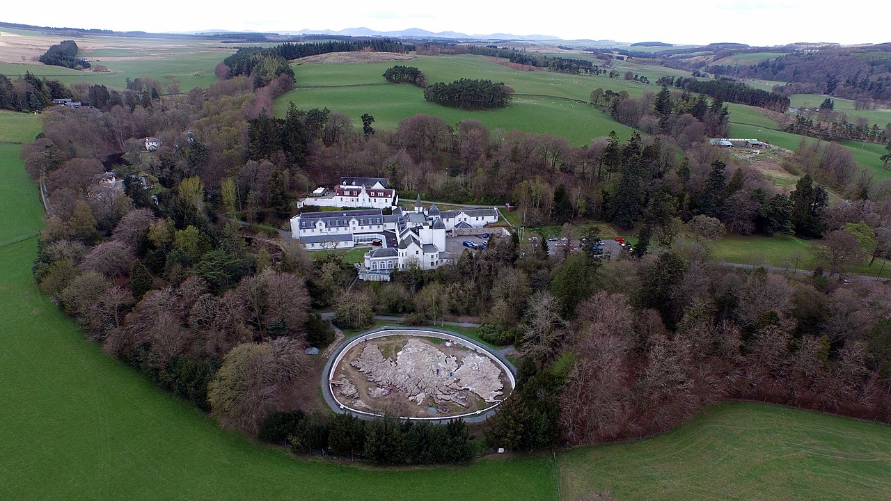
I have written here before about relief maps, focusing on the impressive set of table-top landscapes made at the behest of Louis XIV. These were relatively portable, indoor objects, but there is also a history of larger relief maps made outdoors. Such scaled-down landscapes are subject to the same forces of weathering and erosion as the 'real' landscape in which they are set. Thus, one of the best-known examples, the Great Polish Map of Scotland, has had to undergo a process of restoration recently. Its concrete is more vulnerable to frost and rain than the gneiss and granite of the Scottish mountains, but, unlike the Highlands, it can always be repaired and maintained in a relatively pristine state. The map was constructed in the late 1970s at a hotel owned by the Polish war veteran, Jan Tomasik and designed by cartographer Kazimierz Trafas. Water for the sea, rivers and lochs was diverted from a nearby stream. There are various photographs online - the one below showing the map in snow is quite striking.

Aerial view in snow
Source: Wikimedia Commons (Novemberscot)
The Great Polish Map of Scotland is 50x40m and has been described as the largest relief map in the world. However, according to Wikipedia, a site in Ningxia province, China was spotted in 2006 using satellite imagery measuring 900 by 700 metres. It 'appeared to be a large scale relief model (1:500) of Aksai Chin, a disputed territory between China and India.' You can find this using Google - I have reproduced the satellite image below. It is a reminder that the history of relief maps in China, as elsewhere, has always been associated with politics and territorial claims (a map is the territory...) There are other examples of large-scale relief maps around the world: the Philippines can be seen in reproduced in Rizal Park, Manila, and Guatemala has been scaled down in the 'Mapa en Relieve', as described in an Atlas Obscura article. Such endeavours have been conceived and executed by scientists rather than artists, but I could imagine some more creative alternatives, relief maps that only partially reproduce a landscape, in order to idealise, reinvent or deconstruct it.

A large outdoor relief map in China?
1 comment:
Thank you so much for the detailed article
Post a Comment